Huntable reads British Columbia's hunting regulations, private land, parks, road corridors and legal light for the exact spot under your crosshair, and gives you one answer. It works with no signal.
Coming to Google Play first, iPhone after. The legal check is free in every BC hunting region. Nova Scotia is next.
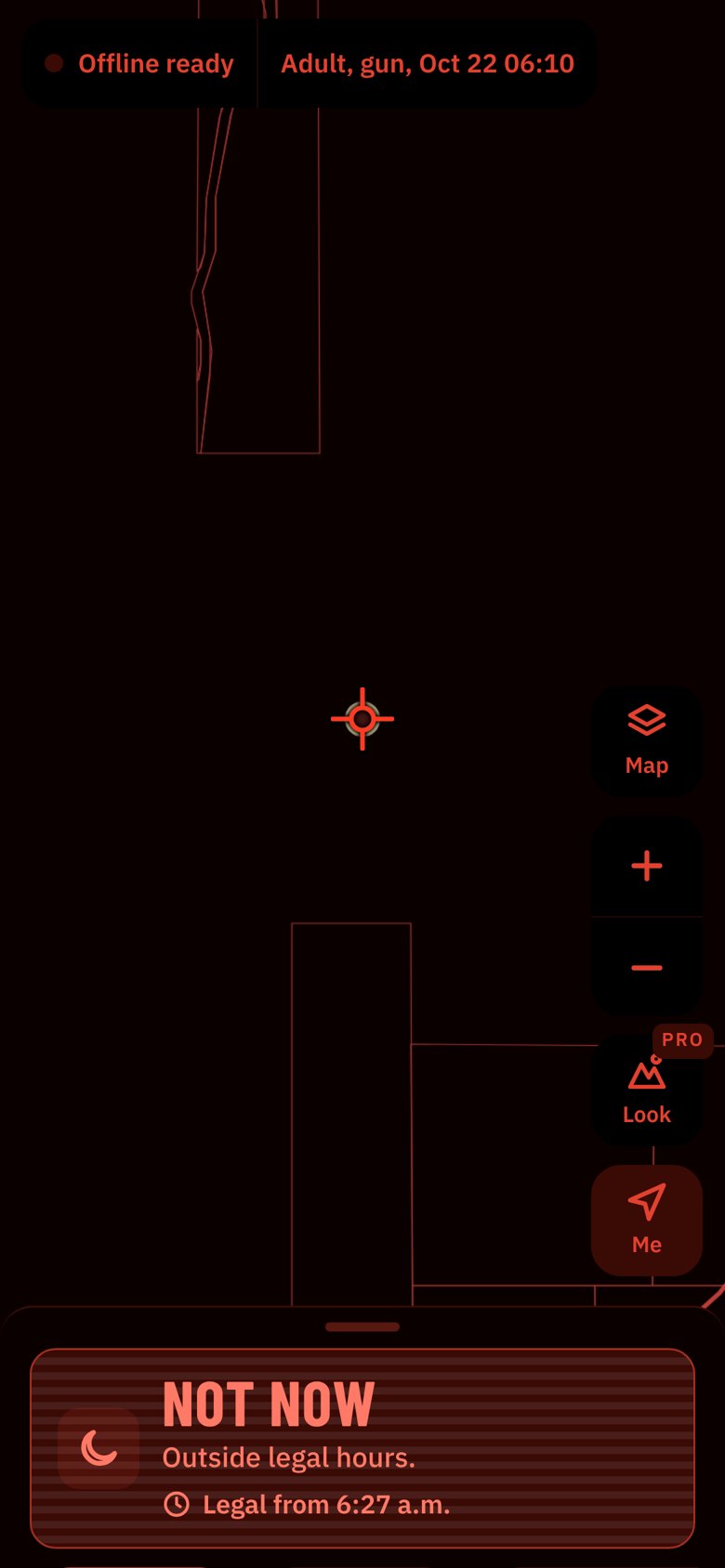
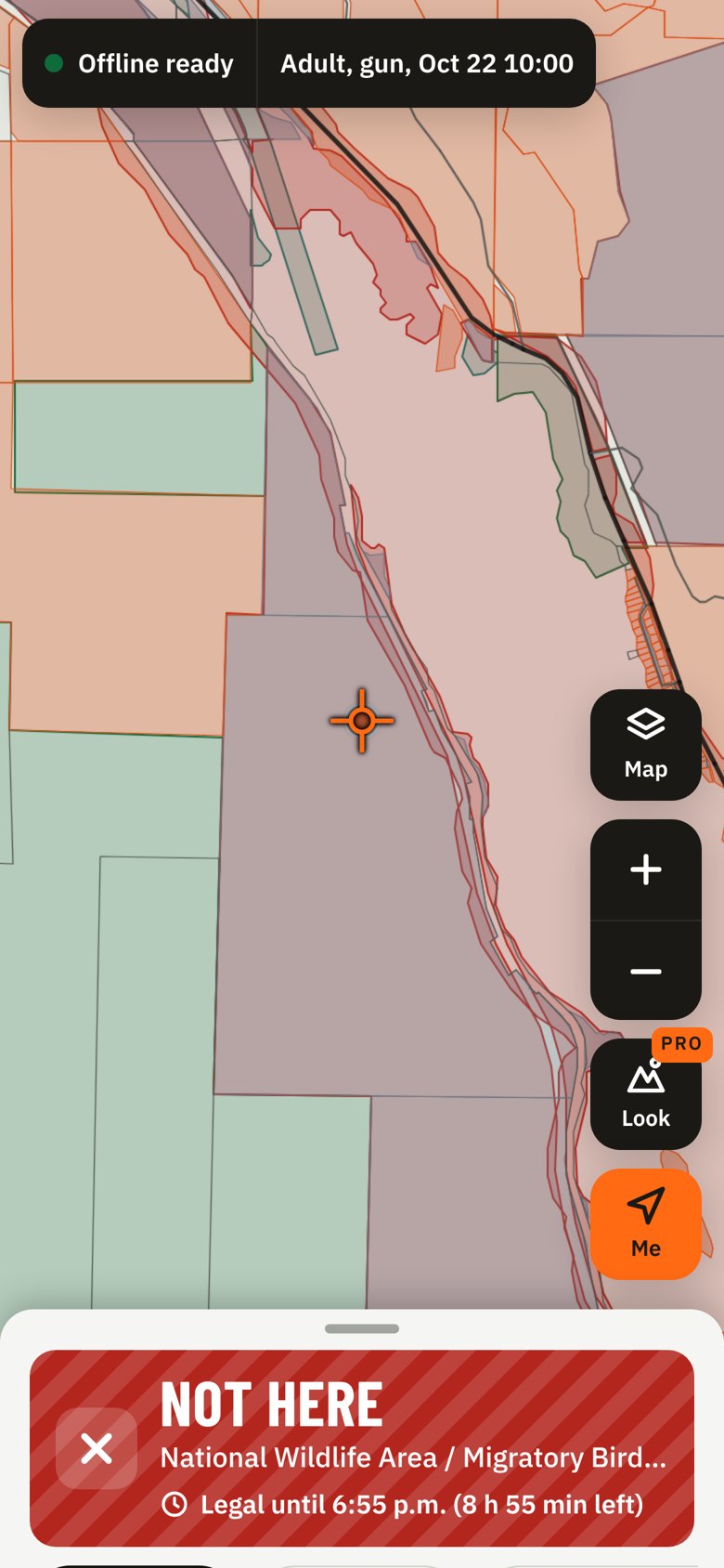
Every check ends in one of these. Each has its own colour and its own pattern, so you can tell them apart in glare, with colour blindness, or on the red night screen.


Save your region once and every check works offline: seasons, parcels, parks, roads and the clock all live on your phone.
Before legal light, switch to Night. Everything turns dim red on black so your eyes stay adjusted to the dark. On Auto it switches by itself when the sun is down.
Move the map and whatever is under the crosshair is checked when you let go. The buttons are sized for gloves and sit where your thumb is.
Your age, weapon and the date and time you pick change the answer. Each check shows its source and the synopsis page it comes from.

Private parcels, parks, wildlife areas and corridors are drawn on the map, and the answer comes with what to do next: ask the owner, wait for legal light, or head to the nearest spot that comes back Open.
A Before you shoot checklist covers what no map can know: posted signs, buildings within 100 m, livestock and in-season closures.

Type a lake, creek, peak or town from BC's 39,000 official place names, or paste coordinates straight from a GPS unit, a map link or a text from your hunting partner. Huntable reads decimal degrees, Garmin-style minutes, degrees-minutes-seconds and UTM from forestry maps.
It shows how it read the numbers before it checks, and copies the answer's coordinates back out in the format you use.

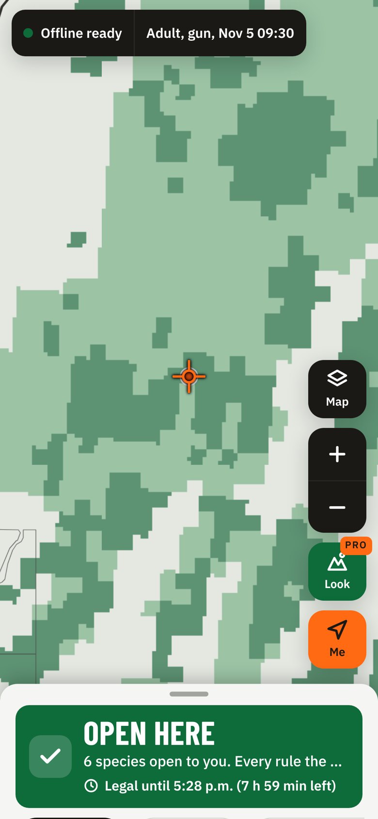
Pro shades the best Crown land for the date you hunt. It ranks each hectare from burns, cutblocks, wetlands, winter range, terrain and distance from roads, and only shades land that's open to you.
It also lists the best spots within 5 km of you, and why each one ranks.
The legal check stays free. Subscriptions are billed through Google Play and renew until you cancel.

Every Wildlife Management Unit in BC has its own page: the 2026–2028 general open seasons from the synopsis, bag limits, regional notices, and the parks and places inside it.
See all 225 units · Seasons by species · Hunting near your town · Legal hunting hours
The same one answer for every Nova Scotia deer management zone: 2026–27 seasons by county, Crown or private land, parks and nature reserves, the setbacks from homes and schools, the Sunday rule, and legal light from half an hour before sunrise.
Nova Scotia seasons by species · Hunting near your town · Legal hunting hours · Join the Nova Scotia list
No. It means every rule the app can check allows it. You're still responsible for knowing the regulations, for permission on private land, and for what you can see on the ground.
The BC Hunting and Trapping Regulations Synopsis, ParcelMap BC, the Digital Road Atlas, BC parks and protected areas, and federal wildlife areas. It's rebuilt every two weeks, and the app tells you how old your copy is.
Yes. Add your LEH authorization in My licences and Huntable treats that hunt as open to you in its zone and dates. Every spot also lists the LEH hunts that include it.
All nine BC hunting regions, from Vancouver Island to the Peace. Nova Scotia is coming next, with all twelve deer management zones: see the Nova Scotia seasons.
We watch the synopsis and its corrections every day. If the data gets more than 30 days old, the app stops answering Open until you update.
Huntable doesn't collect your location: every check runs on your phone. With signal, map tiles for the area you're viewing load from our map server (topo) or Esri (satellite).

Check the spot before you walk in, and again before you shoot. Get Huntable early on Android.
Get early access